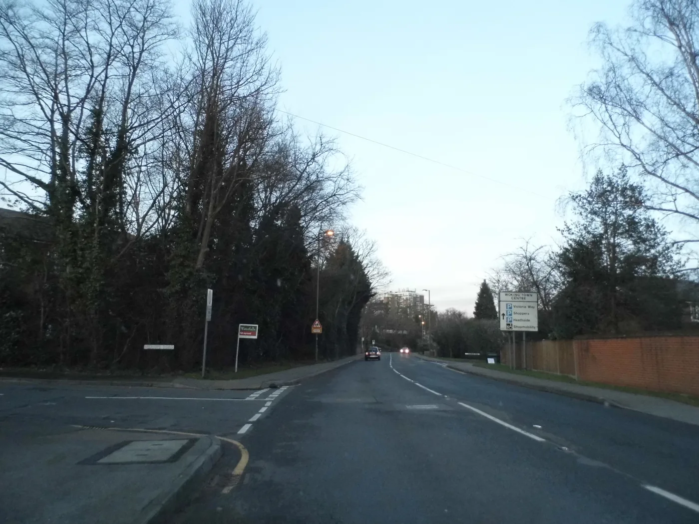

No Woking monitoring site has breached the nitrogen dioxide limit since 2020. The council is revoking the Guildford Road zone, but the map has not caught up.
Woking is about to have no air pollution zone at all. The borough’s remaining air quality management area, a short stretch of Guildford Road declared in 2017, is being revoked after five straight years within the national limit for nitrogen dioxide.
The council set out its position in a report to its Environment and Place Scrutiny Committee on 7 July, published five days earlier. It says national air quality standards are being met and the borough’s management areas “have been (or are to be imminently) revoked” (Air Quality Strategy report EPSC26-012).
Neither map has caught up. The council’s own air quality page still tells residents “we currently have one AQMA within Woking borough along a section of Guildford Road” (Woking Borough Council). Defra’s national register still lists the zone, under the name AQMA Order 2, with no revocation date against it, checked on 30 August (UK-AIR).
What the readings say
Woking has no automatic air quality analysers. It measures nitrogen dioxide with diffusion tubes, which are swapped monthly and sent away for analysis. There were 33 of them in 2024, down from 38 the year before (Air Quality Annual Status Report 2025).
The national objective is an annual average of 40 micrograms per cubic metre. The highest reading anywhere in the borough in 2024 was 30.2, at a site beside the M25. That same site was over the limit in 2021 and 2022, at 40.5 and 43.5, and has been compliant since 2023.
Inside the Guildford Road zone there are three tubes, all on Constitution Hill. The council leaves 2020 out of its own assessment because pandemic traffic levels were not typical, so these are the four years it is relying on.
| Site | 2021 | 2022 | 2023 | 2024 |
|---|---|---|---|---|
| Constitution Hill 4 | 30.2 | 34.5 | 31.7 | 27.8 |
| Constitution Hill 5 | 38.1 | 33.0 | 34.0 | 27.3 |
| Constitution Hill 6 | 34.3 | 34.3 | 34.4 | 29.2 |
| M25 (borough’s highest) | 40.5 | 43.5 | 36.1 | 30.2 |
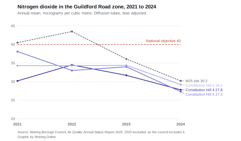
The zone was declared in 2017 on a modelled level of 42.2. The council’s latest return records the current-year level at 29.2 and five years of compliance.
The zone before this one
Woking declared two management areas, and the first has already gone. The Anchor Hill area, in the Knaphill part of the borough, was declared in February 2014 and formally revoked on 17 April 2023. Two tubes were left in place there to check the improvement holds. The reading at Anchor Hill was 27.7 in 2024.
Councillors were told at the July meeting that changes to the traffic signals at Anchor Hill had cut idling and contributed to the improvement (minutes, 7 July 2026).
What replaces it
Defra requires councils without a management area to write an air quality strategy instead, so that improvement is not simply banked. Woking’s covers 2026 to 2028 and shifts the focus away from traffic (draft Air Quality Strategy).
The new target is smoke from wood burners. The strategy notes that particulate emissions from road transport have fallen for decades, while emissions of the finest particles, PM2.5, are rising in some areas because of domestic wood burning. It estimates around one household in ten nationally now has a wood burning stove, often as an occasional fire rather than the main heat source.
Woking cannot yet say what that means locally, because it does not measure it. No particulate monitoring was carried out in the borough in 2024, and the annual report relied on Defra’s modelled background maps instead. The strategy commits the council to investigate indicative PM2.5 monitoring in places where wood burning is likely to be heavy, and to feed into county-wide modelling due to be published in 2027 or 2028.
Other commitments in the strategy include responding to wood smoke complaints with advice first and enforcement only where necessary, drafting standard planning conditions on construction dust and commercial kitchen odour, and keeping the council’s wood burning webpage current. Councillors were also told the council would shortly join AirText, which sends air quality alerts to residents who sign up.
What it means for you
Nothing about your bins, parking or council tax changes because of this. What changes is what the borough is watching, and where you can check it.
- The annual status report is the document with the actual readings, tube by tube. The council’s website says you have to email environmental.health@woking.gov.uk to request a copy. It is in fact published in full on the council’s committee site, linked above.
- If wood smoke from a neighbouring chimney is a problem, the council’s stated approach is education first, and it says it records the outcome of every complaint.
- If you live near Guildford Road or Constitution Hill, revocation does not mean monitoring stops. The council says the tube network continues and will be reviewed again in light of reorganisation in 2027.
One caveat worth keeping in mind. The strategy is written by a council that will not exist in April 2027, when West Surrey Council takes over. The report says the council expects continued work with the Surrey Air Alliance and neighbouring authorities, and the strategy raises the idea of West Surrey adopting local air quality targets and a shared planning document after vesting day. Neither has been decided.
Have your say